visitor to the village was Arthur Young, who made a
tour of East Anglia in 1797, describing its agricultural state and prospects.
Clearly times have changed the concept of how our village is seen, it is today
without doubt one of the most pleasant in the area.
MULETUNE (MOULTON).
Professor Skeat in his ' Place names of Suffolk' , derives
Moulton called Muletuna in doomesday, from the Anglo-Saxon 'Mulan Tun' which
means Mular's Farm. Another meaning could be 'Enclosure where there are mules' (Ekwall).
No historical record of the village in Saxon times survives.
COUNCILS
Moulton R.D - 1894 to 1935
Mildenhall R.D - 1935 to 1974
Forest Heath D.C - 1974
Councils which have been / are responsiple for the village.
The Postal Address is MOULTON, NEWMARKET, SUFFOLK, CB8 8--.
.
In addition to this village there are:
Moulton, Northampton
Moulton, Northwich, Cheshire
Moulton, Richmond, Yorks
Moulton, Spalding, Lincs
Moulton Chapel, Spalding Lincs
Moulton St Mary Norwich
Moulton Seas End, Spalding, Lincs
Moulton, Texas USA
There are several other Moultons throughout the World.
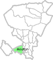
The village is situated two miles (3 Km) south of Kennett Railway Station, The
A14 and A11. three and a half miles (5.6Km) east of Newmarket and eleven miles
(17.6Km) west of Bury St Edmunds. Moulton nestles in the folds of the West
Suffolk hills, so whichever way one leaves the old village of Moulton, it is up
hill, and no matter which road one takes, it is well worth while to turn around
at the hill-top and look back over the village, to see it nestling among the
folds of the hills. The valley runs northwards towards Kentford. The village is
therefore sheltered from extreme gusts of wind.
Perhaps a more appropriate name should be "Moulton le Dale".
Its high ground to the north and west looks far over the
Norfolk Brecklands and the Cambridgeshire Fenland. Ely Cathedral is visible
sixteen miles away.
In the west and north the Parish boundary finishes at the Cambridgeshire border,
which is only just over a mile from the village centre.
The hills surrounding rise to about 300ft (91M), starting from the west
their names are:
Warren Hill
Folly Hill
Primrose Hill
Plantation or Bonfire Hill
There is also high ground towards Dalham, Ashley and Cheveley.
There was much more woodland in the past, many of the elms
were lost in the 1970's and some hedgerows have been removed. The soil is light,
sandy with chalk as a subsoil. The village itself is a little over 100ft (30.5M)
above sea level. It has a good record of health, judging from the small death
rate and the age of its older inhabitants.
The neighbourhood bordering on the ancient Icknield Way, must have been of
importance in British and Saxon times. Moulton adjoins Exning originally Ixing,
having the significant syllable ICK, so characteristic of those portions of
Cambridgeshire and Suffolk which according to some authorities are associated
with the 'Iceni', over whom Queen Boadicea ruled. Exning became a royal
residence in Saxon times, being the birthplace of Queen Etheldreda, who founded
Ely Cathedral and later became a saint. Moulton has Roman and Norman sites in
the area, one particular close to Moulton Paddocks Estate.
Through the village runs intermittently a stream which
rises near both Woodditton and Cowlinge. The stream flows nothwards from Dalham
and going beyond to Kennett (which gives it its name), to join the Lark near
Mildenhall. Its waters then travel to the Ouse, ending up in the Wash.
Before a more recent clearing of the river bed, this stream
generally dry in summer and Autumn, frequently overflowing its banks in winter
and spring, flooding Brookside and sometimes threatening the cottages. Towards
Kennett the meadows could also be flooded.
During the winter months of 1965/66, the river had registered to a depth of 3
feet at the car bridge end. In the winter the flow of water is surprisingly fast
in view of the vegetation growing on its bed. Teasel, thisle and dock grow to a
height of 3/5ft in season.
Since the damaging floods of 1968, Anglian Water has taken charge of the river.
The river is now cleared twice a year.
The sewage treatment plant which is sited between Moulton
and Dalham, discharges into the river, enabling it to flow through the village
even in the driest weather. The water table in the valley has been considerably
lowered by the continuous extraction of water from the pumping station on the
Gazeley Road.
It is doubtful whether the river would ever flow naturally throughout the year,
as it did occasionally for several years. After a severe thunderstorm, it has
been known in past years, for children to run in front of the advancing water,
sometimes resulting in wet feet. Years ago the village was well known for soft
fruit notably its 'Greengage' trees.


 An old edition of the Suffolk Chronicle Mercury stated
"A writer of a century ago remarked that Moulton contains nothing remarkable"
An old edition of the Suffolk Chronicle Mercury stated
"A writer of a century ago remarked that Moulton contains nothing remarkable"